KARAKURUM TREKS & TOURS
21-B, Hotel Metropolitan, G-9 Markaz, P.O. Box 2803, Islamabad - Pakistan
Telephone : +92-51-2264876, 2250317, Fax : +92-51-2264192, 2653196
E-Mail : karakurm@isb.comsats.net.pk
Skardu Office: Hotel Yurt & Yak, Link Road, Skardu
Telephone: +92-5831-52856
United Kingdom Office
Mobile: +447884305742
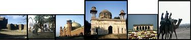
Pakistan stretches from the Arabian Sea to the high mountains of central Asia and covers an area of 803,944 square kilometers. The distance from southwest to northeast is 1800 kilometers and the southern west to east, Pakistan is bordered by Iran, Afghanistan, China and India.
The country is divided into four provinces: Sindh, Baluchistan, Punjab and the North-West Frontier Province (NWFP). Geographically Pakistan falls into three main regions: the mountainous north where the Hindu Kush, Karakorams and Himalayan ranges meet; the vast but sparsely populated plateau of Baluchistan; and the Punjab and Sindh plains of the Indus River and its five mountains tributaries. The Indus plains apart, Pakistan is mostly mountainous desserts and arid plateau.
Sindh, the southernmost province of Pakistan, derives its name from the River Indus, which divides it in two. It is a land of very little rainfall, dependent on the river for its fertility. The province encompasses the lush, irrigated belt, and the western edge to the Kirthar Hills, which separate it from Baluchistan. In winter the climate is pleasant with temperatures between 25 and 50 C. Sindh is famous for its handicrafts, particularly its textiles, pottery and lacquered woodwork. Patchwork quilts, block-printed cloth and striped woven cloth are available in bazaars all over the province. The best time to visit Sindh is the winter months fro mid-November to mid-March, when the daytime temperature fluctuates between 15 and 25 C, in summer it hovers around 35 to 45 C.
Baluchistan, the vast arid waste of baluchistan makes up to 44 percent of Pakistan. The great empty spaces, the formidable mountain ranges and the fiercely independent character of distances are enormous and the occasional oasis surrounded around it. The mountains are jagged and eroded, folded and twisted by violent earth moments into amazing gray, red, black, turquoise and purple. Much of the province consists of a high peaks of over 3000 meters. At the moment Quetta, the provincial capital and the main road from Sakurai through the Bolan Pass to Quetta, and from Quetta to Iranian border, are the only part of Baluchistan open to foreign tourists.
Punjab, meaning Land of Five Rivers, is the richest, most fertile and mostly heavily populated province of Pakistan. More than 60 million people live here, or about 60 percent of Pakistan's population. Geographically, Punjab is a land of contracts, encompassing the alluvial plain of the Indus River and its pine-covered foothills of the Himalayas, and the strategy convoluted lunar landscape of the Potwar Plateau and the Salt Range. Monsoon rains fall in northern Punjab. The be;t from Lahore to Rawalpindi - Islamabad and north into the foothills. The best time to visit northern Punjab is the spring, from February to April, and in the autumn, from September to November, Southern Punjab is exothermally bot in summer, so Multan is at its best in winter, from November to February.
North-West Frontier Province, NWFP runs for over 1, 100 kilometers along the border with Afghanistan. Peshawar is the capital, and the heart of rivers. This was the center of the ancient Kingdom of Gandhara and is rich in archaeological remains. The northern half of the province consists of five river valleys (the Kaghan, Indus Swat, Dir and Chitral), all running north to south. As they are on the northern edge of the monsoon belt, the valleys are fairly green and partly wooded in their southern sections.
Northern Chitral and the upper regions of the Indus valley are mountains deserts and depend on irrigation for cultivation. The area south of Peshawar is also outside the monsoon belt and consists of low rocky mountains and wide gravelly plains. Green oases surround every source of water. Most of the water courses in this area are seasonal; they run from west to east, down to the Indus River, and dry much of the year.
The Karakoram Highway is the greatest wonder of modern Pakistan. It connects Pakistan to China, twisting through three great mountain ranges - the Himalayas, Karakorams and Pamirs and follows one of the ancient silk routes along the Indus, Gilgit and Hunza rivers upto the Chinese border at the Khunjerab Pass; it then crosses the high central Asian plateau before winding down through the Pamirs to Kashgar, on the edge of the Taklamakan Desert. The Khunjerab Pass is only open for foreigners from 1 May to 30 November. Gilgit and Hunza are at their most beautiful in April, when the fruit trees are in bloom, and in October, when the autumn colors are at their best. In July, it is very hot in Gilgit and along the Indus Valley. From Islamabad up the Karakoram Highway to Kashgar is a four-day journey providing there are no rock falls. Or you can fly to Gilgit and take two or three days to drive to Kashgar.
Baltistan lies north of Indian-held Kashmir along the Indus River between the Karakoram Mountains and the uninhabited Deosai Plateau. Skardu, its capital, is the starting-point for some of the best trekking and mountains in the world. Baltistan is a high-altitude desert. It rises from 1,500 meters above sea level to 8,616 meters at the submit of K-2, the second-highest mountain in the world. The average rainfall here is less than 100 millimeters a year but whenever possible the step mountainside is cut into tiny terraces and irrigation by a network of small water channels from the glacier streams. In summer the melting snows swell the Indus to a ranging torrent sweep away everything in its path, so only the gentler side streams can be used for irrigation.
Gilgit, the capital of Pakistan's Northern Areas, is a thriving frontier town that has expanded rapidly to include about 30,0000 inhabitants since the Karakoram high way was opened in 1978. It sits in a wide irrigated bowl 1500 meters above sea level at the eastern end of the Gilgit Valley. The snow-covered pinnacle of Domani 6134 meters and part of the Rakaposhi Range stands guard at the eastern end of town, while a semicircle of barren peaks around 4500 meters high encloses the valley on the other three sides.
Hunza the valley spread around the Ralaposhi. The isolation of this famous beauty spot ended with the opening of the Karakoram Highway in 1978, and now tourism is quickly encroaching on Hunza. Yet, despite the concrete hotels that increasingly scar the hillside, the grandeur of the setting is so powerful that Hunza retains its appeal. At an altitude of about 2400 meters, Hunza has an average annual rainfall of about 145 millimeters. The wettest months are April, May, July and August which together account for 65 % if the total, leaving the valley fairly dry from October to March.
 |
KARAKORAM TREKS & TOURS |